Route of the 3 Nations
2016-04-17 Hotel Pessets&Spa, has the following proposed for you to enjoy both from driving and what our land can offer you:This is a 430 km route that starts from Sort, combines some of the best roads for international motorcycle touring, crossing, as the name of the route indicates, 3 nations:
It crosses a part of the the catalan Pyrenees in the province of Lleida (Spain), a part of the french pyrenean, Andorra from tip to tip to return at last, to Spain. It is a intensive but popular and funny route, complemented by spectacular views of the best mountain passes.
If you are provisioned with a good supply of food and drink, this route will offer bikers the chance to enjoy the exhilarating experience of the catalan pyrenees in a single day. But if what you are searching for more relax and comfort, on the road there are many good restaurants with local cuisine, especially concentrated in Andorra.
As mentioned, the startpoint is in Sort — Hotel Pessets:
Sort, with its 2230 inhabitants, is the capital of the region.
Its main tourist attractions are its nature and the River Noguera Pallaresa, with adventure sports like white water rafting, canyoning, kayaking… It has also recently become famous for its lottery centre «La Bruixa d'Or» (Golden Witch), with many people stopping off here to try their luck.
Take the C-13 in direction Llavorsí, following the Noguera Pallaresa countercurrent.
Llavorsí is a village that was built literally embedded between mountains and it is divided by the Noguera Pallaresa. There's where most activities, like rafting, have its start point.
In Escaló you will find Sant Pere del Burgal, a Romanesque Benedictine monastery. The monastery was first mentioned in a precept of Count Raymond of Toulouse in 859. It later became a priory of the abbey of Roussillon. It fell into decline and was secularized in 1570 and confiscated in 1835. It contains frescoes dated to the 11th century.
Continue the road C-28 to get to Port de la Bonaigua (el. 2072 m.). It is a mountain pass that connects Esterri d'Àneu in the comarca of Pallars Sobirà with Vielha e Mijaran in the comarca of Vall d'Aran. The Baqueira-Beret ski resort is located at the top of the pass.
Please take a minute to enjoy the spectacular views you will have from above.
You just get to the Vall d'Aran:
The local economy is based almost entirely on tourism and winter sports. The ski resort of Vaquèira-Beret is one of the largest in the Pyrenees.
Naut Aran is the second largest municipality in Catalonia in terms of surface area (225.8 km², behind Tremp), and was created in 1967 by the merger of the municipalities of Arties, Salardú, Gessa, Tredòs and Bagergue. The name literally means «Upper Valley» in Aranese, and both the Garonne (Garona) and the Noguera Pallaresa have their sources on the territory of the municipality. The town hall is in Salardú. The municipality is linked to Vielha by the C-28 road, which continues to Alt Àneu over the Port de la Bonaigua (2072 m). This road, (which you just crossed) the higher stretches of which are impassable in winter, was the only route between the Aran Valley and the rest of Spain before the opening of the Vielha tunnel in 1948.
A number of local churches have been classified as historic-artistic monuments: Church of Sant Andreu de Salardú, which houses a thirteenth-century sculpture of Christ (el Crist de Salardú); Church of Santa Maria, in Arties and Church of Santa Eulària d'Unha (twelfth century).
Vielha e Mijaran is a municipality in «La Vall d'Aran». It was created in 1970 by the merger of the municipalities of Arròs e Vila, Betlan, Escunhau, Gausac, Vielha and Vilac: some of the former municipalities retain some privileges as «decentralised municipal entities» as does the village of Betren. Mijaran literally means «Middle Aran» in Aranese, as the inhabited part of the municipality is situated in the valley of the Garonne (Garona). The Noguera Ribagorçana has its source on the territory of the municipality, on the opposite side of the watershed. The «ajuntament» (town hall) is in Vielha, spelled Viella in Catalan and Spanish, which is also the capital of Aran.
Now you have to continue taking the N-230 direction Bossòst.Bossòst is a small Pyrenean village and municipality located in the Aran Valley. Situated on the left bank of the river Garona, the village is bordered by Les, Vilamòs, Arres and France (by Bagnères-de-Luchon).
The local football club, Union Esportiva de Bossòst, has the rare distinction of playing its regular matches in a 'foreign' competition (it plays in the French minor leagues).
The Col du Portillon (elevation 1,293 metres) is a mountain pass in the Pyrenees on the border between France and Spain. It connects Bagnères-de-Luchon in France with Bossòst in the Val d'Aran
The Col du Portillon was first used in the Tour de France in 1957, since when it has featured 18 times, most recently in 2006, when the leader over the summit was David de la Fuente..
France
Bagnères-de-Luchon, also referred to as Luchon, is a French commune and spa town in the Haute-Garonne department in the Midi-Pyrénées region of south-western France.
Continue through Avenue des Pyrénées D618a, Route de Montauban D 27, then D 125, Cier-de-Luchon and Avenue du Général Galliéni N 125,Saint Béat.
The town of Saint-Béat is an old Gallo-Roman city, situated in a narrow gorge of the valley of the Garonne. Since ancient times, white marble quarries of everything that made the country's wealth was exploited. Charlemagne even made a key position on the road to Spain and gave it its name. The city retains this prosperous period of many testimonies, as the twelfth century castle and chapel overlooking the city.
Follow the D44 to Boutx, after it the D57 to Saint-Lary.
Audressein is situated on the former Route nationale D 618, the «Route of the Pyrenees», at the start of the climb to the Col de la Core some 18 km south-west of Saint-Girons. Access to the commune is by the D618 road from Argein in the west which passes through the centre of the commune and the village and continues to Engomer in the north-east.
While it will only take you half an hour to explore the village, a pause is recommended because the centre of the village is very picturesque, with a small river crossed by a bridge, a traditional village centre and an interesting early church that includes some medieval frescoes. The path that leads to the church follows alongside the river. The church in Audressein has a most unusual and ornate belltower with two arches, but it is the medieval frescoes in the porch area that are of most interest to visitors. Although these are rather faded with the centuries several can still be seen quite clearly.
You can also see a 'hydraulic harvester' next to the bridge in Audressein but it is only open to the public a couple of times a year.
Mérens-les-Vals, as its name implies, has several valleys. The village is at the confluence of three valleys: Ariège, Nabre and Morgoulliou. The village has a train station (Gare de Mérens-les-Vals) on the Portet-Saint-Simon–Puigcerdà railway. The night train from Gare d'Austerlitz, Paris to Latour-de-Carol stops here. The journey taking about nine hours. There are six local trains a day to Toulouse, this journey takes 2 hours and 15 minutes.
Take the N-20 to L'Hospitalet-près-l'Andorre.
L'Hospitalet-près-l'Andorre literally translates to «The Hospital Near Andorra». The area has a history of vulnerability to winter avalanches: one such in 1895 killed 12 (nearly 10% of the commune's population at the time), and much destruction was also caused in 1906 and 1929.[1][2] Avalanches have from time to time cut the N20, the main road through the commune, the most recent case being in 2008.
Andorra
You are just about to meet the next mountain pass:
Port d'Envalira (el. 2408 m.) is a mountain pass in the Pyrenees in Andorra, that connects El Pas de la Casa with the rest of the country. It is the highest paved road in the Pyrenees. The climb has been featured several times at the Tour de France and Vuelta a España cycling races. The construction of a toll tunnel to avoid the mountain pass started in 1999 and opened to traffic in 2002. The tunnel is located at an altitude of about 2000 meters and is nearly 3 kilometers long.
Canillo is located northwest to thePrincipality of Andorra, and counts on an area of 120 square kilometers, being this way the largest parish throughout the principality. The parish has various population centres, and the capital is Canillo. It is considered as the summit of Andorra, since it is one of the highest parishes in the principality. Besides, Canillo is a contemporary and mountain tourist centre that offers quality and peace to the visitors. The environment has privileged spots of great beauty that constantly invite to enjoy the nature with an ample offer of active tourism.Canillo, El Tarter y Soldeu are the localities that act as entries to Grandvalira, the largest area of the Pirineo to ski. There, a fabulous offer of activities related to snow is provided to guests, and it isn’t strange because you can enjoy approximately five months of snow per year in Andorra.
Visiting the Meritxell Sanctuary is a must visit if you are passing through Canillo, since it will let you know better the Andorran history and culture. Furthermore, it is very interesting to know the Romanesque legacy of the parish, in which you will find the Sant Joan de Caselles Church.
The parish of Ordino is located 1,300 metres high, in the eastern side of Andorra. This parish has an area of around 85 square kilometres, of which a third are forests, with nice landscapes of great value. The parish of Ordino is divided into eight areas: Ordino (the capital city), El Serrat, Llorts, La Cortinada, Arans, Ordino, Sornàs and Segudet.
Ordino has an important artistic heritage, mainly standing out the manor houses of the Museum d'Areny Plandolit and of Casa Rossell, must-visit places if you want to discover about the history of Andorra.
Romanesque architecture is also quite prominent in Ordino, as it has many interesting places and monumental structures. The most relevant ones are: Iglesia de Sant Martí de la Cortinada Church with its wall paintings and the Iglesia de Sant Corneli y Sant Cebrià Church, both from the Middle Ages.
Ordino also boasts important museums, standing out: Museo Casa de Areny-Plandolit House Museum, Sant Jordi Iconographic and Christianism Museum, Nicolai Siadristy Miniatures Museum, and the Postal Museum. The Muela y Aserradero de Cal Pal Museum and the Nature Center of La Cortinada are also interesting. Other interesting places to visit are the Vall de Sorteny Nature Park, the Botanical Garden and the National Auditorium of Music of Andorra.
La Massana is located in the the western side of the Principality of Andorra. This high mountain parish houses the highest peak in the whole country, the Alto de Comapedrosa, with 2,943 metres high. From there you’ll have wonderful views over the Valls del Comapedrosa Communal Park.
Although La Massana doesn’t have the monumental attractions of other Andorran parishes, it boast to offer one of the best hotel and restoration deals in the country, as well as many commercial establishments where you’ll be able to buy high quality products at great prices.
Andorra La Vella is the capital city and nerve center of the Principality of Andorra. The city emphasises its commercial relevance and great gastronomic diversity, able to meet the highest demands.
The city is located to the left bank of Grandvalira bed, allowing urban and natural environment to be closely related. Moreover, in the center of the city is Central Park, a privileged place designed for rest and leisure. Andorra La Vella is filled with interesting walks and routes, like Margineda or Santa Coloma ones, continuously connecting you with nature.
Likewise, the traveller will also find interesting mountain routes, like for example theCamino del Prat Primer, while those passionated for culture and nature will find in theValley of Madrieu, declared world heritage by UNESCO, an idyllic place.
Romanesque and Pre-Romanesque art can be seen here, especially both in the capital city and the town of Santa Coloma, emphasising the monumental Iglesia de Santa Coloma Church and the La Margineda Bridge.
Other iconic places in Andorra La Vella are: La Casa de la Vall House, built in the 16th century and headquarters of the Consell General; the Iglesia de Sant Esteve Church, a monumental church of Romanesque origin dating from the 12th century and located in Plaza Princep Benlloch Square; the ruins of the Enclar castle, the Iglesia de Sant Vicent d'Enclar Church and the Iglesia de Sant Andreu Church.
The contemporary culture is kept alive in Andorra La Vella thanks to diverse festivals, like the International Clowns Festival or the Festival of Music and Dance; and important festivities, like the Escudella de Sant Antoni, the major festival of Andorra La Vella, Carnival, or the Medieval Market.
We return toSpain:La Seu d'Urgell is the capital of the comarca Alt Urgell, head of the judicial district of la Seu d'Urgell and the seat of Bishop of Urgell, one of the Andorra co-princes. It is in the district of Alt Pirineu i Aran (High Pyrenees and Aran), and is the town with the most inhabitants, having 17.4% of the district population. La Seu d'Urgell and Puigcerdà together have 30% of the population of the area.
It is located at the confluence of the Segre and the Valira rivers. The city is in the local region of Urgellet, a Pyrenean region formed by 16 municipalities of Alt Urgell. Urgellet and Andorra were the originary County of Urgell with capital in la Seu d'Urgell before the county expansion to the south. Alt Urgell is the gateway to the state of Andorra and the proximity to this important population center and economic activity is largely one of the reasons for the current drive of the city of la Seu d'Urgell within Alt Pirineu i Aran.
The town's patron saints are Saint Ot of Urgell,[9] Saint Sebastian, and the Virgin of Urgell. While the Virgin of Núria and Sant Ermengol are the main patrons of the diocese of Urgell. Sant Ermengol is the most prominent in the city than other patrons. Probably that's why there are various events throughout the year dedicated to Sant Ermengol, such as the Sant Ermengol Fair, one of the oldest in Catalonia, and the altarpiece of Sant Ermengol.
The Parc Olímpic del Segre, built in 1992 for the Barcelona Summer Olympic Games, is a pump-driven canoe and kayak sports venue located adjacent to the historical centre of la Seu d'Urgell.
The Port del Cantó is a mountain pass of 1718.4 meters located at the border of the municipalities of Soriguera, the region of Pallars Sobira and Montferrer i Castellbò, the region 's Alt Urgell.
It will be the last pass yoy will cross, and it is located at kilometer 260 of the N-260.
It is the ridge that connects the Serra Seca, north of the Serrat Pratprimer the south.
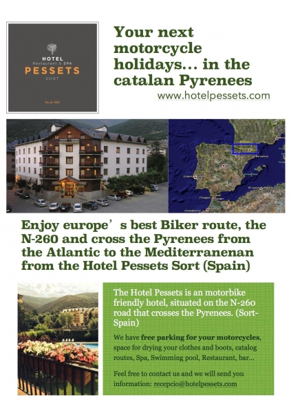
Endpoint: Welcome back to Sort — Hotel Pessets
We hope you enjoy it!
For more information about us:
www.hotelpessets.com / info@hotelpessets.com